Message Boards Message Boards

GeoGraphics, non-rectangular imagesize

Dear All,

I would like to show some geo-graphics, but I'd like to create an image of some specific dimensions, so I tried:

GeoGraphics[Entity["Country", "Netherlands"], ImageSize -> {500, 800}]

enter image description here

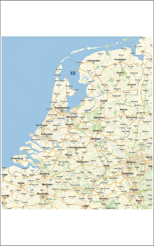
This gives me a 500*500 square map, with 150 pixels white pixels on top and bottom. Is there an easy way to force this to be also a 'map' ?

POSTED BY: Sander Huisman
2 Replies

Though you are completely correct, it is very cumbersome; because you want to size your plot in general. I don't want the find the exact georange such as to get a 500*800 image.

Giving an image-size, and geocenter, and a georange (in meters for example) should be enough to give me an image that fits (at least) this range).

POSTED BY: Sander Huisman
POSTED BY: David Reiss
Reply to this discussion
Community posts can be styled and formatted using the Markdown syntax.
Reply Preview
Attachments
Remove
or Discard

Group Abstract Group Abstract