I've been playing around with some of the Geo* features in Mathematica 10, and I've come across something that seems like it should be simple to do, but I can't quite see how.
If you want to see a map of all the countries in the European Union, it's straightforward:
GeoListPlot[EntityClass["Country", "EuropeanUnion"]]
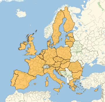
This will produce a nice map of all the countries in the EU:

However, I'd like to see a map with the polygons joined anywhere they touch. That is, most of continental Europe should be one large polygon, no visible border between Sweden and Finland, etc etc. Is there a simple way to accomplish this, or am I doomed to have internal borders?