Project Description
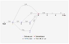
This project aims to identify the projection and location of a map input as an image. The algorithm processed input image using a series of image processing functions, then is converted into a vector using a neural network. Then, another network graph processes the vector to associate with one of the six inhabited continents. Once the represented continent is identified, the vector-converted map follows a similar process to identify its projection. Variety of detectable projections vary by continent; as one may have guessed, North America supplies the most, and South America and Africa the least.
Summary of Results and Conclusions
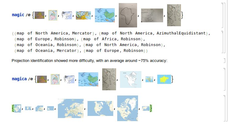
Simply picking one out of six, the continent classifier boasts its accuracy at ~90%., successfully identifying hand-drawn, upside down maps, and sometimes making manlike mistakes:
Future Directions
SImilar procedures can be taken to further better the algorithm; for each continent, a classifier that identifies which part of the continent can be written, and so on. Additional projections can be added to be identified given that enough training set is provided.


