It also appears that there were lots of attendees from around the Boston area:
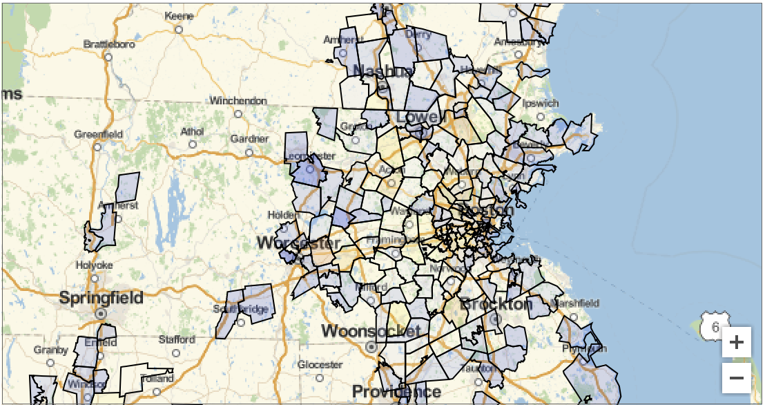
Given that you are from Boston College
StringTake[WikipediaData["Boston College"], 1985]
you will probably be interested in that area. You can also calculate the distance between the different zip code areas and the Boston College:
Quiet[distances =
  GeoDistance[Entity["University", "BostonCollege::m4rnc"], #] & /@  cleanentities[[All, 1]]]
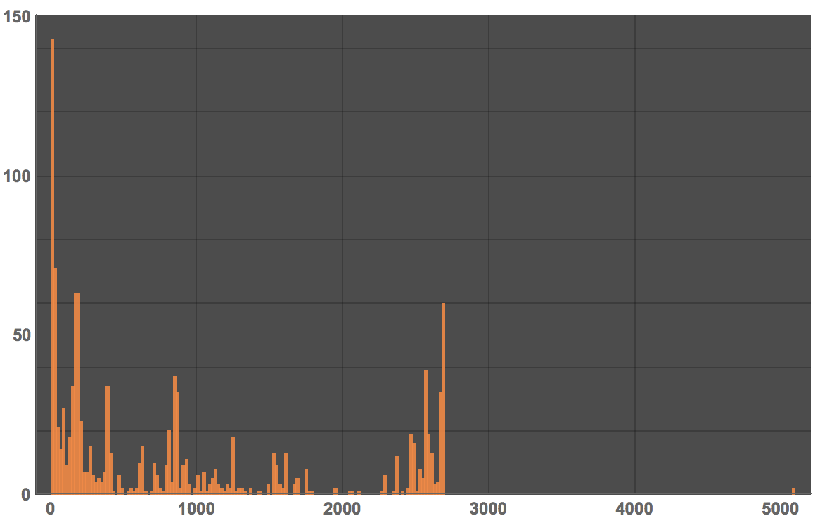
Here is a histogram of these distances:
Histogram[Cases[distances, _Quantity], 200, ImageSize -> Large,
 PlotTheme -> "Marketing", LabelStyle -> Directive[Bold, Medium]]
Of course this is not really a fair histogram, because there are different numbers of participants, so we have to include that:
weighteddistances =
Cases[Flatten[ConstantArray[#[[1]], #[[2]]] & /@ Transpose[{distances, Floor /@ cleanentities[[All, -1]]}]], _Quantity];
and then
Histogram[weighteddistances, 200, ImageSize -> Large, PlotTheme -> "Marketing", LabelStyle -> Directive[Bold, Medium]]
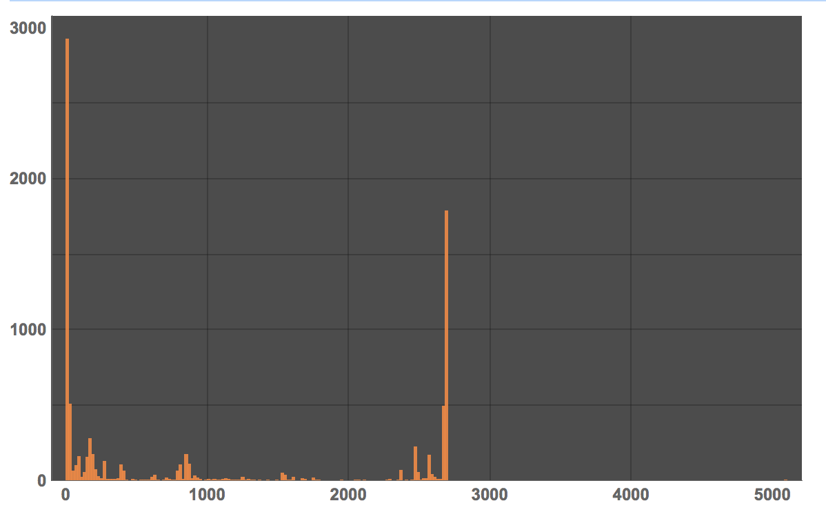
The average travel distance is (ignoring the zip codes we could not identify):
Mean@QuantityMagnitude@UnitConvert[weighteddistances, Quantity[1, "Miles"]]
1026.43 miles.
Cheers,
Marco


