Group Abstract Group Abstract

Message Boards Message Boards

[?] Set thumbnail of image as GeoMarker?

Posted 6 years ago

I have a directory of images, taken with a drone, that contain GPS Position data. I've successfully plotted points showing where each image was taken, using GeoListPlot, but what I'd like to do is show a thumbnail of each image at the point it was taken.

POSTED BY: David Sprague
Posted 6 years ago

Hi David,

Use GeoGraphics with an image GeoMarker. e.g.

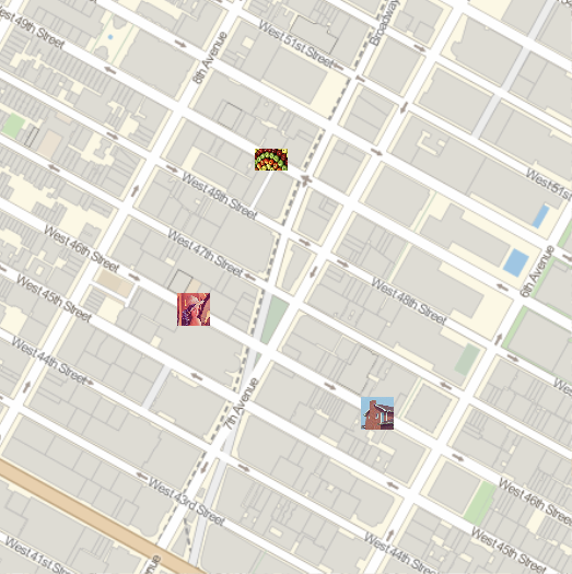
images = ExampleData[{"TestImage", #}] & /@ {"Lena", "Apples", "House"};
locations = {{40.759132, -73.986348}, {40.761014, -73.985052}, {40.757814, -73.98328}};

GeoGraphics[
 GeoMarker[First@#, Last@#] & /@ Transpose[{locations, images}],
 GeoRange -> Quantity[.25, "Miles"]]

enter image description here

POSTED BY: Rohit Namjoshi
Reply to this discussion
Community posts can be styled and formatted using the Markdown syntax.
Reply Preview
Attachments
Remove
or Discard