Hi Brian,
GeoVectorPlot expects a list of positions and the corresponding vectors. e.g.
hawaiiPolygon = Entity["AdministrativeDivision", {"Hawaii", "UnitedStates"}]["Polygon"];
(* Extracts points *)
hawaiiPoints = Flatten[hawaiiPolygon[[1, 1]], 1];
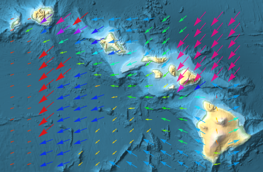
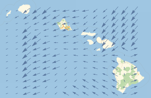
(* Get the wind data for noon on Oct. 1, 2019 *)
wind = WindVectorData[hawaiiPoints, DateObject[{2019, 10, 1, 12, 0, 0}], "DownwindGeoVector"];
GeoVectorPlot[wind]
Different background and vector coloring
GeoVectorPlot[wind, GeoBackground -> "ReliefMap", VectorColorFunction -> Hue]