Message Boards Message Boards

How to crop non-rectangular images in the map?

There is an image classification problem about land cover/land use~~

How to get only the image in the sampling area (inside the circle)?

Attachments:
POSTED BY: Tsai Ming-Chou

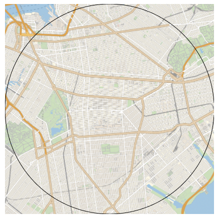
I think you need to remove the GeoRange value. Note that GeoRange->d means radius d.

GeoGraphics[GeoCircle[sampleCenter, Quantity[5, "Kilometers"]], 
 GeoRangePadding -> None, GeoBackground -> "StreetMapNoLabels"]

enter image description here

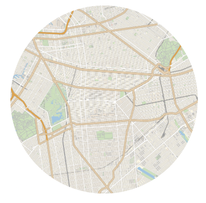
Or do you want only the interior of the circle?

GeoGraphics[{GeoStyling["StreetMapNoLabels"], 
  GeoDisk[sampleCenter, Quantity[5, "Kilometers"]]}, 
 GeoBackground -> None]

enter image description here

Reply to this discussion
Community posts can be styled and formatted using the Markdown syntax.
Reply Preview
Attachments
Remove
or Discard

Group Abstract Group Abstract