Some typical example:
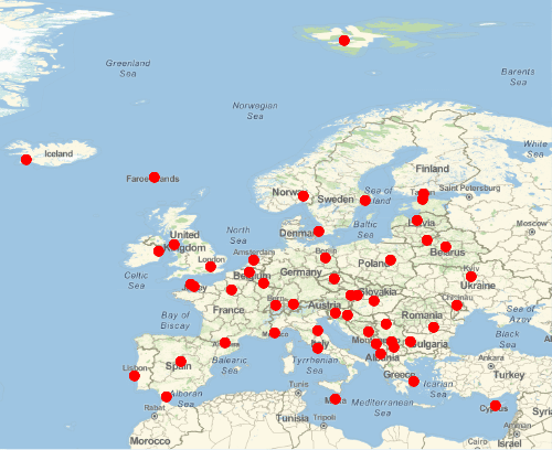
capitals = EntityValue[CountryData["Europe"], "CapitalCity"]

positions = EntityValue[capitals, "Position"];
{distance, order} = FindShortestTour[positions];

imgs = ParallelTable[
  GeoGraphics[{
    Red, Thick, GeoPath[positions[[order[[;; k]]]]],
    Red, PointSize[.02], Point[positions]},
   GeoCenter -> GeoPosition[{54.78, 5.73}],
   GeoProjection -> "Equirectangular",
   GeoRange -> {{30, 83}, {-25, 40}},
   ImageSize -> 500]
  , {k, 1, 52}]
If you are working in the Wolfram Cloud:
CloudExport[imgs, "GIF", Permissions -> "Public"]
And for the desktop:
Export["test.gif", imgs]