I have the following code:
img= [IMAGE];
out=GeoGraphics[{GeoStyling[{"GeoImage",img}],poly},ImageSize->1000,GeoRange->"World",GeoProjection->"Equirectangular"]
Export["out.png",out]
'out' looks good and only has some slight problems with anti-aliasing around the lines in img. See also the notebook. The image in mathematica looks like:
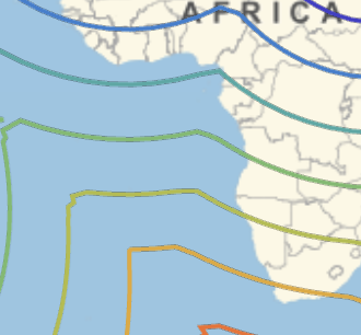
But the exported file looks much worse:
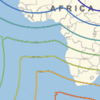
The 'overlay' is created in mathematica, rastering a ContourPlot as "Image" with Background->None. The overlay image (img) does not show this anti-aliasing artifacts. The preview in mathematica shows a bit of anti-aliasing problems, but the export a lot.
How can I remedy the (lack of) anti-aliasing? Any ideas?
Attached is the notebook.
 Attachments:


