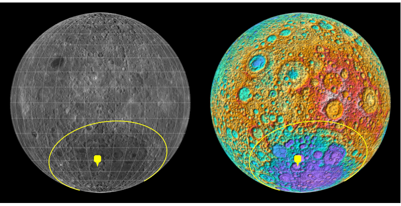
China successfully sent a lander and rover to the far side of the Moon. It landed within one of the largest impact structures in the solar system, known as the Aitken Impact Basin which is 2500km in diameter. You can use GeoGraphics to visualize the landing site and the Aitken Impact Basin which is more easily seen in relief.
With[{
  change4 = GeoPosition[{-45.5, 177.6}],
  aitkencenter = GeoPosition[{-53, -169}],
  aitkenradius = Quantity[2500/2, "Kilometers"]
  },
 GraphicsGrid[{GeoGraphics[
      {GeoMarker[change4, "Color" -> Yellow], Yellow, Thickness[.004],
        GeoCircle[aitkencenter, aitkenradius]},
      GeoModel -> Entity["PlanetaryMoon", "Moon"],
      GeoProjection -> {"Orthographic",
        "Centering" -> GeoPosition[{0, -180}]}, GeoRange -> All,
      GeoZoomLevel -> 2, Background -> Black, ImagePadding -> 20,
      GeoGridLines -> Quantity[10, "AngularDegrees"],
      GeoGridLinesStyle -> Directive[Opacity[0.2`], GrayLevel[1]],
      GeoBackground -> #] & /@ {"Satellite", "ReliefMap"}},
  ImageSize -> 800, Spacings -> 0]]


