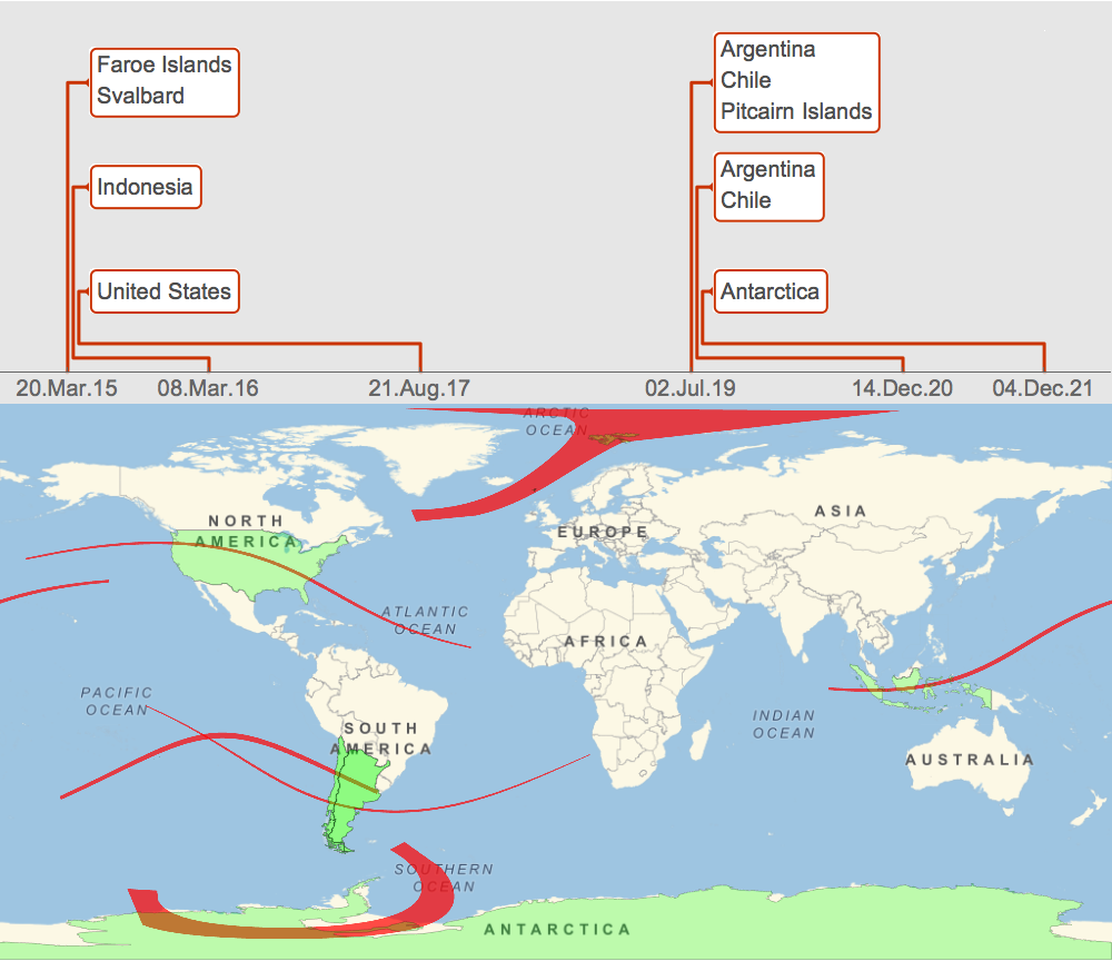
Here is an improved version of timeline showing the map and territories of the eclipses too. This image shows spectacular powers of computational infographics. We see right away that a spectacular total solar eclipse will span US from coast to coast on August 21, 2017 (se a related discussion below). We also see that Argentina and Chile will get lucky getting the eclipse twice in a row. Most subtly and curiously, the recent solar eclipse is unique in the sense that it covers almost completely two territories: Faroe Islands and Svalbard. This means any inhabitant of these territories can see the total eclipse from any geo-location, cloudiness permitting. Usually it is quite the opposite, the observational area of a total eclipse is much smaller than the territory area it spans and most of the inhabitants would have to travel to observe their total eclipse (fortunately no visas needed).
Module[{

   times, polys, eclcou,
   inter = {DateObject[{2015, 1, 1}], DateObject[{2021, 1, 1}], All}},

  times =
  SolarEclipse[inter, "MaximumEclipseDate", EclipseType -> "Total"];
  polys =
  SolarEclipse[inter, "TotalPhasePolygon", EclipseType -> "Total"];
  eclcou = GeoEntities[#, "Country"] & /@ polys;

 Column[{

   TimelinePlot[Association[Thread[Column /@ eclcou -> times]],
       DateTicksFormat -> {"Day", ".", "MonthNameShort", ".",
      "YearShort"},
       Ticks -> {times}, Background -> GrayLevel[.9],
    PlotTheme -> "Web", AspectRatio -> 1/3],

   GeoGraphics[{
     GeoStyling[None],
     Opacity[.7], Red, polys,
     Green, Opacity[.25], EdgeForm[{Black, Opacity[.2]}],
     Polygon /@ GeoEntities[polys, "Country"]},
    GeoProjection -> "Equirectangular", GeoRange -> All]

   }, Spacings -> 0]
 ]


